Heat and humidity will be the story this weekend





Conrad Straden–The Tech
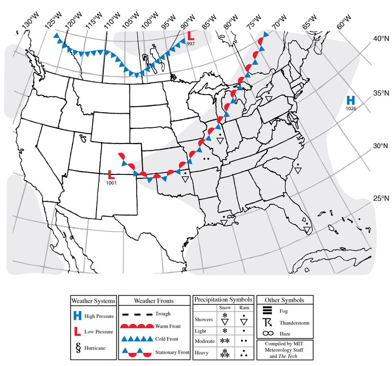
After drenching rain on Monday, we will return to quite hot and oppressive weather over these next few days. The National Weather Service has issued a heat advisory for today and tomorrow, with heat index values reaching up to 100°F. Temperatures will be near 90 degrees; high humidity will make it feel nearly ten degrees warmer. There is a slight chance for an evening thunderstorm the next three nights; Friday and especially Saturday look more favorable for thunderstorm development, but at the moment, activity is forecasted to be scattered, if there’s any at all.
Next week, the heat will ease, with highs generally in the 80s and progressively getting cooler as the week progresses. Sunsets will now be before 8 p.m. as we move into late summer. The North Atlantic Basin continues to remain quiet in terms of tropical cyclone activity. The leading suppressant is the El Niño conditions due to warmer sea surface temperatures in the equatorial Pacific. Any tropical system development will be restricted closer to America as opposed to starting out off the coast of North Africa, which is typically the area to watch for development this time of year.
Today: Partly Cloudy. High around 90°F (32°C). Southwest winds 5–10 mph with gusts to 15 mph.
Tonight: Clear. Low around 73°F (23°C). Southwest winds 5–10 mph with gusts to 15 mph.
Friday: Sunny. High around 92°F (33°C) and overnight low around 71°F (22°C). West winds 0–5 mph.
Saturday: Sunny. Chance for a thunderstorm. High around 90°F (32°C) and overnight low around 70°F (21°C). Southwest winds 5–10 mph with gusts to 20 mph.
Sunday: Sunny. High around 90°F (32°C) and overnight low around 67°F (19°C). West winds 5–10 mph with gusts to 20 mph.